Walking the West Highland Way
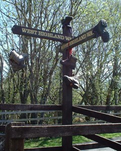
The West Highland Way, Scotland’s best known long distance footpath rises from it’s lowland base at Milngavie on the outskirts of Glasgow through a whole variety of spectacular countryside and scenery to Scotland’s outdoor capital, Fort William, in the Scottish highlands.
An estimated 40 to 50 thousand people a year enjoy walking parts of “The Way”; around 10 to 15 thousand make it all the way to Fort William. The record time is 15 hours 44 minutes and 50 seconds although some people have taken several weeks – and enjoyed every minute of it.

Route Planning
Over the years we have completed the Way several times – with about 25 different people of all ages; all have completed it successfully, so it came as something of a surprise to see just how many hobble in to Tyndrum then go no further. The reasons are often because they have been a bit too ambitious and are trying to walk the whole way in four or five days, they are carrying too much in their rucsac or they simply have not prepared and planned properly.
Go at a comfortable pace
Unless you are a regular and experienced long distance walker we suggest for a comfortable trip you spread the 95 miles over at least seven days covering an average of about 14 miles (20 kilometres) per day. There is a slight problem in the second half of the walk as there is a distinct shortage of accommodation between Bridge of Orchy/Inveroran and Kinlochleven but this is made a bit easier by the fact that most accommodation providers in these places will arrange drop off and pick up transport to help you cope with this (and local bus services also tie in quite well with the Way).
Obviously have a stop in Tyndrum!
If you have more time we suggest you add an extra day on to the second half of the walk, and/or you spend an extra day in Tyndrum. At just over halfway it is the ideal place to enjoy a day of rest (and have a ‘wee’ celebration) before completing the second half of the Way. You may also find the walk a lot easier, and more enjoyable, if you arrange to have your rucsac carried by one of the luggage transfer services that operate along the Way.
Suggested Itinerary
Try the Nevis Gorge
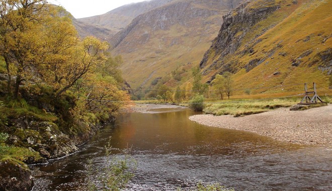
To stretch your legs without the four thousand feet climb the walk through the Nevis Gorge at the far end of Glen Nevis is highly recommended – and you can cross the Steall Bridge at the end of the Gorge just for fun.

Plan ahead – and have fun!
There are countless other variations on the above and each should plan according to their own, or their groups, abilities. If you are walking with a group you should plan your route to suit the least fit group member. Please remember that one unfit member trying to keep up with the rest of the group will not only have a bad experience themselves, but may also spoil the experience for the other group members. The difficulty for many is not walking fourteen miles in one day but in having the stamina and (stubborn???) perseverance to walk fourteen miles for seven consecutive days – and carrying a heavy rucsac. As mentioned earlier we have seen some sorry sights hobbling into Tyndrum, but with a wee bit of preparation you needn’t be one of them. The above route breaks the Way down into manageable days and provided you prepare properly in advance the distances suggested should be quite easily achievable (even by non-regular walkers).
The other factors which causes people to give up on the walk is firstly carrying too much luggage and secondly the wonderful (???) Scottish weather. To make things easier on the rucsac carrying front see West Highland Way luggage carrier services. As regards the weather that’s a bit more difficult. The Way is mostly on the West, therefore the wetter, side of the country, and although some people have walked all the way from Milngavie to Fort William in glorious sunshine, most are not so fortunate. A wee bit rain never harmed anyone you may think, but after several hours walking, wet boots and wet socks are a major cause of blisters. Try carrying a couple of extra pairs of dry socks (and some talcum powder) with you – and not to be a total pessimist regarding weather it is also worth taking along some sun block. Fourteen miles (or twenty Kilometres in European currency) takes a good few hours so don’t get too baked along the way.
Finally the West Highland Way attracts thousands of people every year and many new friendships are born along the way. If you are the sociable type start your walk on a Saturday, most people do and you will undoubtedly make a few new friends along the way and in the inevitable pub afterwards. If you prefer your own company keep your head down or start midweek. You will still see a few faces along the way but most will be well ahead or well behind you.
West Highland Way Height profile
We do hope you find the above guide useful. If you do decide to walk the ‘Way’ go with our best wishes. Please say hello to us, and Milo our dog, when you pass us by in Tyndrum
Activities Links
Our Address
By The Way Hostel and Campsite
Lower Station Road,
Tyndrum,
Stirlingshire,
FK20 8RY
(see location in larger map)
Tel: 01838-400-333
Email: info@tyndrumbytheway.com
(or use our Contact page)
Free WiFi
Exploring the West Highlands
Tyndrum is an excellent base for you to explore all the activities and outdoor pursuits available in Scottish West Highlands – please check out the Activitiessection of our site for more info.
Have some questions?
We’ve put together a list of the most frequently asked questions from our guests which may help you out
From our Visitors Book


Read more Visitor Feedback.
